Vanadzor (Vanadzor K'aghak')
Vanadzor (Վանաձոր) is an urban municipal community and the third-largest city in Armenia, serving as the capital of Lori Province in the northern part of the country. It is located about 128 km north of the capital Yerevan. As of the 2011 census, the city had a population of 86,199, down from 148,876 reported at the 1979 official census. Currently, the town has a population of approximately 76,200. Vanadzor is the seat of the Diocese of Gougark of the Armenian Apostolic Church.
In the official records of the Russian Empire, the city was labelled as Karakilis Bolshoye (Караклисъ Б.). Following the Sovietization of Armenia, the city was renamed Martunashen (Մարտունաշեն, alternatively Martunakan) in 1926 after Armenian Bolshevik revolutionary Alexander Miasnikian. On 3 January 1935, it was renamed Kirovakan (Կիրովական), after the popular Russian Bolshevik leader Sergey Kirov. A close associate of Armenian First Secretary Aghasi Khanjian, Kirov had been assassinated on December 1 of the previous year. On 25 June 1992, after Armenia gained its independence, Kirovakan was renamed back to its initial name Vanadzor after the Vanadzor River which flows through the city. The name Vanadzor is composed of the Armenian words vank (վանք, "monastery") and dzor (ձոր, "valley"). Thus, the name of the city means "valley of the monastery."
In the official records of the Russian Empire, the city was labelled as Karakilis Bolshoye (Караклисъ Б.). Following the Sovietization of Armenia, the city was renamed Martunashen (Մարտունաշեն, alternatively Martunakan) in 1926 after Armenian Bolshevik revolutionary Alexander Miasnikian. On 3 January 1935, it was renamed Kirovakan (Կիրովական), after the popular Russian Bolshevik leader Sergey Kirov. A close associate of Armenian First Secretary Aghasi Khanjian, Kirov had been assassinated on December 1 of the previous year. On 25 June 1992, after Armenia gained its independence, Kirovakan was renamed back to its initial name Vanadzor after the Vanadzor River which flows through the city. The name Vanadzor is composed of the Armenian words vank (վանք, "monastery") and dzor (ձոր, "valley"). Thus, the name of the city means "valley of the monastery."
Map - Vanadzor (Vanadzor K'aghak')
Map


Country - Armenia
 |
 |
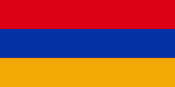
| Flag of Armenia | |
Armenia is a unitary, multi-party, democratic nation-state with an ancient cultural heritage. The first Armenian state of Urartu was established in 860 BC, and by the 6th century BC it was replaced by the Satrapy of Armenia. The Kingdom of Armenia reached its height under Tigranes the Great in the 1st century BC and in the year 301 became the first state in the world to adopt Christianity as its official religion. The ancient Armenian kingdom was split between the Byzantine and Sasanian Empires around the early 5th century. Under the Bagratuni dynasty, the Bagratid Kingdom of Armenia was restored in the 9th century. Declining due to the wars against the Byzantines, the kingdom fell in 1045 and Armenia was soon after invaded by the Seljuk Turks. An Armenian principality and later a kingdom Cilician Armenia was located on the coast of the Mediterranean Sea between the 11th and 14th centuries.
Currency / Language
| ISO | Currency | Symbol | Significant figures |
|---|---|---|---|
| AMD | Armenian dram | Ö | 2 |
| ISO | Language |
|---|---|
| HY | Armenian language |